
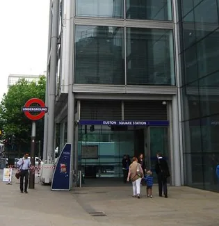
Euston Square: Location and Local Orientation
Euston Square Underground station is recorded by TfL at Euston Square Station, Euston Rd, London. Use Euston Rd to anchor your taxi or cab enquiry rather than a broad neighbourhood name. Its Underground fare-zone reference is 1; a Tube fare zone does not set the price of a taxi or minicab.
The closest other Underground station positions in this directory are Warren Street (0.19 km), Euston (0.30 km), and Goodge Street (0.57 km). Those figures are straight-line distances calculated from TfL coordinates, not walking routes, station interchanges or journey-time estimates.
Named Places Around Euston Square
Named green-space landmarks around Euston Square include Gordon Square Garden (public park or garden, approximately 0.30 km to the mapped boundary); Church of Christ the King (religious grounds, approximately 0.36 km to the mapped boundary); Fitzroy Square (public park or garden, approximately 0.37 km to the mapped boundary). These are straight-line distances derived from the TfL station position and Ordnance Survey’s April 2026 mapped site polygons. A boundary can be much closer than a usable entrance: these figures do not describe walking routes, road access or a place for a driver to wait.
If your journey ends at Gordon Square Garden, give its own entrance or street address when booking. A taxi booking for the Underground station identifies a different destination from the surrounding park, grounds or sports site. Confirm visitor arrangements with the site before travelling. Contains Ordnance Survey data © Crown copyright and database right 2026.
Euston Square and UCL’s Bloomsbury Campus
UCL identifies Euston Square among the closest Tube approaches to its Gower Street site in Bloomsbury. That university entrance is separate from Euston mainline station. Give a campus building or accommodation address when requesting a cab, rather than treating every UCL destination as the Gower Street main gate.
Tube Connections at Euston Square
Euston Square is served by Circle line, Hammersmith & City line, and Metropolitan line services, so your arrival line matters when you agree a station meeting point. Circle: Great Portland Street and King's Cross St. Pancras are the neighbouring named stops shown around Euston Square in TfL’s route sequences. Hammersmith & City: Great Portland Street and King's Cross St. Pancras are the neighbouring named stops shown around Euston Square in TfL’s route sequences. Metropolitan: Great Portland Street and King's Cross St. Pancras are the neighbouring named stops shown around Euston Square in TfL’s route sequences.
Check current branches, stopping patterns and planned work with TfL before choosing an onward Tube connection or cab.
Luggage, Access and Your Minicab Meeting Point
Use the current TfL station guide to check the access route that suits your party. This station’s captured record does not provide a sufficiently clear facility summary to infer a complete step-free route. Avoid treating a map pin as proof that a car can reach the exact entrance you will use.
For a minicab at Euston Square, give your actual entrance or nearby address, arrival line and luggage count. Agree a permitted road meeting place; the station address and photograph are location references, not waiting instructions.
Airport Taxi Planning from Euston Square
For an airport cab from Euston Square, start with the station collection address and the airport terminal, rather than only “London airport”. King's Cross St. Pancras is an example of a Piccadilly-line interchange shared with the Circle, Hammersmith & City, and Metropolitan network; use TfL’s planner to compare that rail option on the day. A dispatcher must separately confirm the road journey, price, vehicle and any airport charges.